Fill Function
Fill
Fills the map between selected sites or sites with the ‘calibrated’ state (see the ‘State > Set to ‘Calibrated’ context menu command).
To simply interpolate a rectangular selection, use the Interpolate functions.
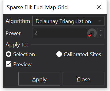
There are different algorithms available for filling the map. Which algorithm you choose to use will depend on your purpose.
The Delaunay Triangulation will generally give the best results but it does require at least three sites to be selected.
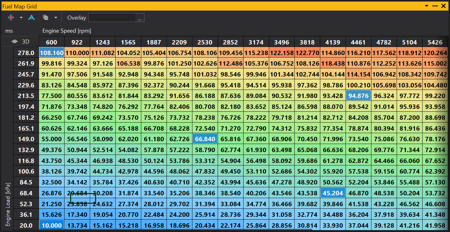
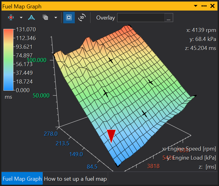
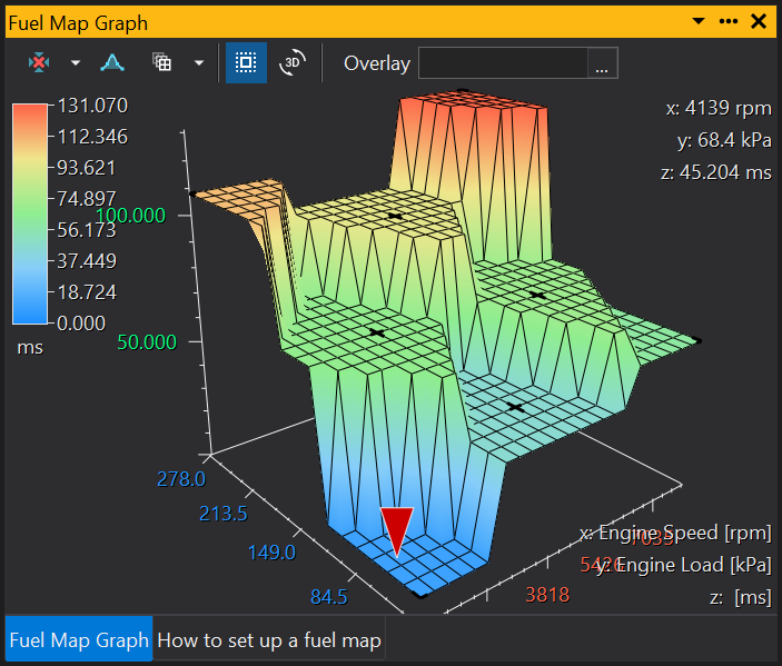
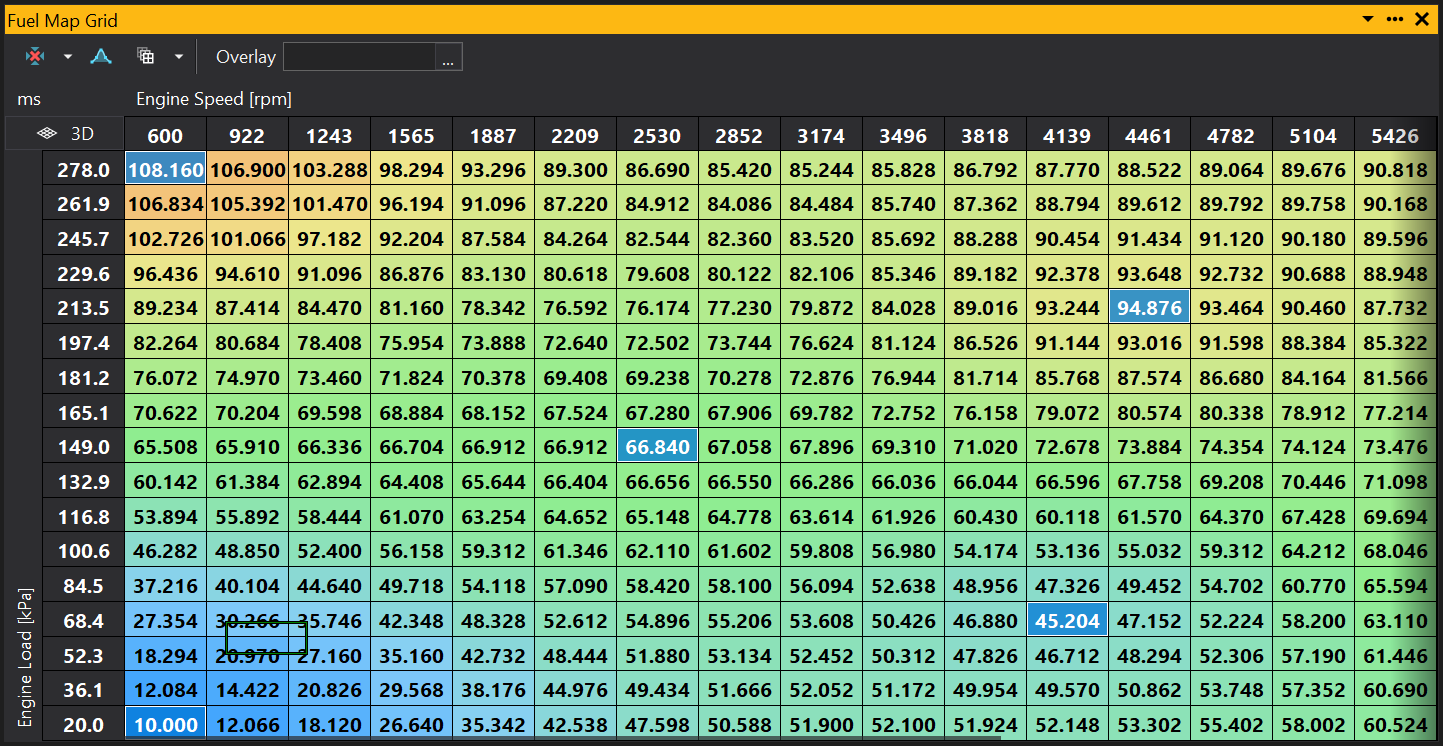
Starting with the following map, a number of sites have been selected by Ctrl-Clicking on the map to generate a ‘sparse’ selection.
The fill algorithms will be discussed with this as a reference.
Our intention is to fill the map sites between the selected sites (i.e. fill the non-selected sites).


Nearest Algorithm
For each unselected site in the map, the closest selected site is found and the site value is set to match.
Using our example map above, you would get the following result:
Inverse Distance Weighting Algorithm (IDW)
For each site in the map, the site is given a value based on the inverse of the distance from surrounding selected sites.
The ‘power’ channel adjusts the weighting value and will affect the curvature of the resulting map surface.
Using our example map above, you would get the following result:
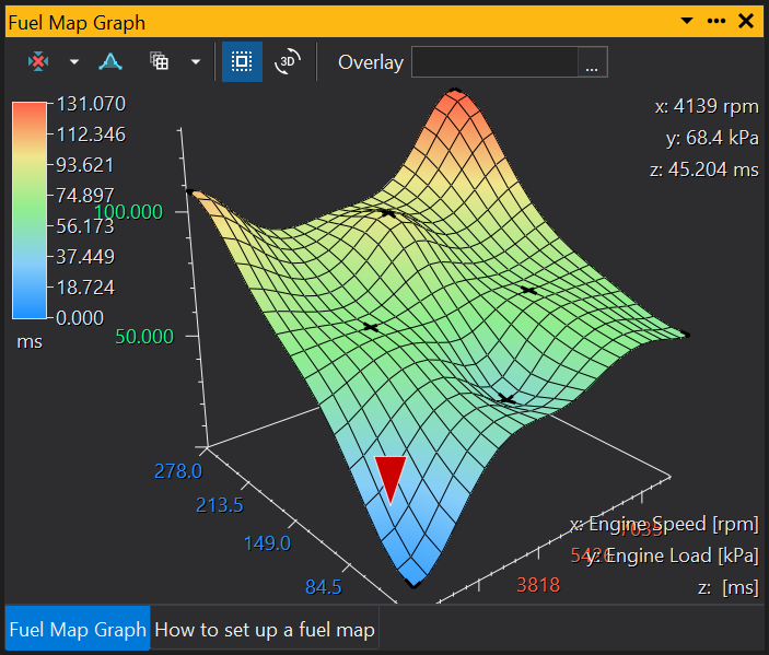
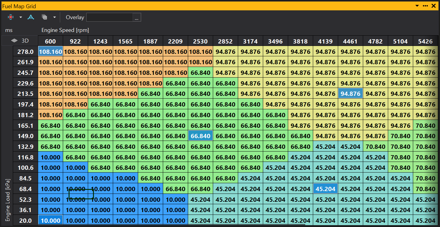
Delaunay Triangulation Algorithm
This algorithm triangulates between the selected sites. It finds the most appropriate triangles to use using the Delaunay algorithm (more information is available on the web).
You must have at least three sites selected to use this algorithm and it is recommended that you always select the corner sites because they will not be extrapolated.
There may not always be an appropriate triangulation and in such cases some areas may be missed on the map (for example if you have three collinear points). If this occurs, try modifying your selection or manually adjust the missing areas.
Using our example map above, you would get the following result: